
Image: Location relief map United Kingdom Eden

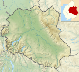
Description: Relief map of Eden District, Cumbria, England in 2010. Inset highlights Eden among all the districts of Cumbria. Equirectangular map projection on WGS 84 datum, with N/S stretched 170% Geographic limits: West: 3.11°W East: 2.05°W North: 54.90°N South: 54.33°N
Title: Location relief map United Kingdom Eden
Credit: This file was derived from: Cumbria UK relief location map.jpg: Durham UK relief location map.jpg: North Yorkshire UK relief location map.jpg: Eden UK ward map 2010 (blank).svg:
Author: Cumbria UK relief location map.jpg: Nilfanion, created using Ordnance Survey data Durham UK relief location map.jpg: Nilfanion, created using Ordnance Survey data North Yorkshire UK relief location map.jpg: Nilfanion, created using Ordnance Survey data Eden UK ward map 2010 (blank).svg: Nilfanion, created using Ordnance Survey data derivative work: Dr Greg
Usage Terms: Creative Commons Attribution-Share Alike 4.0
License: CC BY-SA 4.0
License Link: https://creativecommons.org/licenses/by-sa/4.0
Attribution Required?: Yes
Image usage
The following 13 pages link to this image:
