
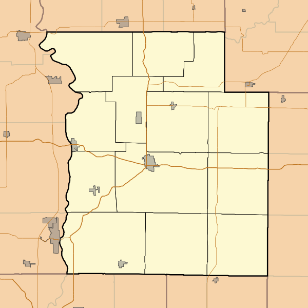
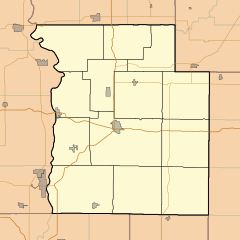
Image: Locator map of Parke County, Indiana

Size of this PNG preview of this SVG file: 600 × 600 pixels. Other resolution: 240 × 240 pixels.
Original image (SVG file, nominally 768 × 768 pixels, file size: 115 KB)
Description: This is a map of Parke County, Indiana, USA which includes township borders.
Title: Locator map of Parke County, Indiana
Credit: My own work, using freely-available shape data from the United States Census Bureau with a custom-written MapScript application
Author: Omnedon
Usage Terms: Public domain
License: Public domain
Attribution Required?: No
Image usage
The following 43 pages link to this image:
- Annapolis, Indiana
- Arabia, Indiana
- Armiesburg, Indiana
- Banner Mills, Indiana
- Bellmore, Indiana
- Bloomingdale, Indiana
- Bradfield Corner, Indiana
- Bridgeton, Indiana
- Catlin, Indiana
- Coloma, Indiana
- Coxville, Indiana
- Diamond, Indiana
- Ferndale, Indiana
- Guion, Indiana
- Hollandsburg, Indiana
- Howard, Indiana
- Hudnut, Indiana
- Jessup, Indiana
- Leatherwood, Indiana
- Lena, Indiana
- Lodi, Indiana
- Lusk Home and Mill Site
- Lyford, Indiana
- Madalline, Indiana
- Mansfield, Indiana
- Mansfield Roller Mill
- Marshall, Indiana
- Milligan, Indiana
- Minshall, Indiana
- New Discovery, Indiana
- Numa, Indiana
- Nyesville, Indiana
- Parkeville, Indiana
- Piattsville, Indiana
- Rockville, Indiana
- Rosedale, Indiana
- Smockville, Indiana
- Sylvania, Indiana
- Tangier, Indiana
- Turkey Run State Park
- West Atherton, Indiana
- West Melcher, Indiana
- West Union, Indiana

All content from Kiddle encyclopedia articles (including the article images and facts) can be freely used under Attribution-ShareAlike license, unless stated otherwise.