
Image: Locmap-Haro-Boundary2
No higher resolution available.
Locmap-Haro-Boundary2.png (384 × 309 pixels, file size: 61 KB, MIME type: image/png)
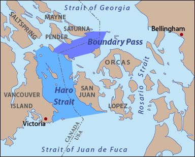
Description: This is a locator map of Haro Strait and Boundary Pass. I, Pfly, made it with ArcGIS, Adobe Illustrator, and Adobe Photoshop.
Title: Locmap-Haro-Boundary2
Credit: Own work
Author: Pfly
Usage Terms: GNU Free Documentation License
License: GFDL
License Link: http://www.gnu.org/copyleft/fdl.html
Attribution Required?: Yes
Image usage
The following image is a duplicate of this image (more details):
The following page links to this image:

All content from Kiddle encyclopedia articles (including the article images and facts) can be freely used under Attribution-ShareAlike license, unless stated otherwise.