
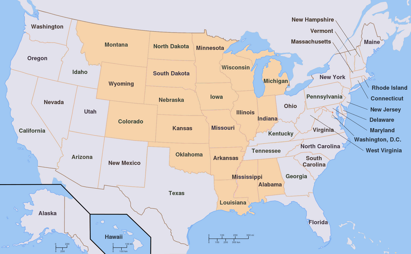
Image: Louisiana Territory versus current US States

Size of this preview: 800 × 495 pixels. Other resolutions: 320 × 198 pixels | 2,000 × 1,237 pixels.
Original image (2,000 × 1,237 pixels, file size: 433 KB, MIME type: image/png)
Description: Map of the current states of the United States that in whole or in part of its territory constituted the Louisiana Territory (1805 to 1809).
Title: Louisiana Territory versus current US States
Credit: Own work This file was derived from: Map of USA with state names.svg:
Author: It was originally uploaded to the English Wikipedia with the same title by w:User:Wapcaplet
Usage Terms: Creative Commons Attribution-Share Alike 3.0
License: CC-BY-SA-3.0
License Link: http://creativecommons.org/licenses/by-sa/3.0/
Attribution Required?: Yes
Image usage
There are no pages that link to this image.

All content from Kiddle encyclopedia articles (including the article images and facts) can be freely used under Attribution-ShareAlike license, unless stated otherwise.