
Image: México División Política-República Central
Size of this preview: 557 × 599 pixels. Other resolutions: 223 × 240 pixels | 1,098 × 1,181 pixels.
Original image (1,098 × 1,181 pixels, file size: 319 KB, MIME type: image/png)
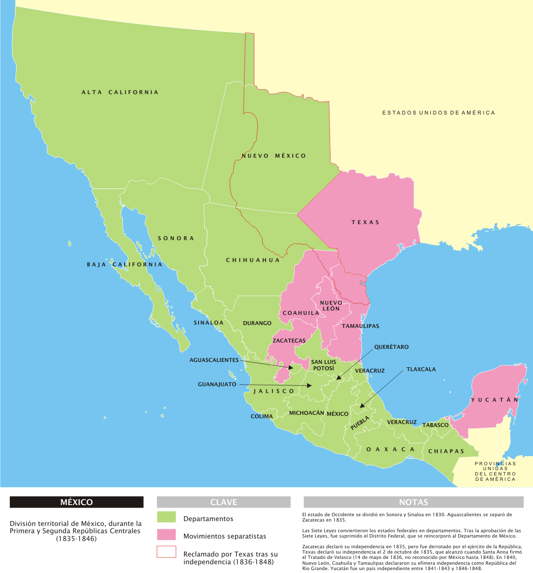
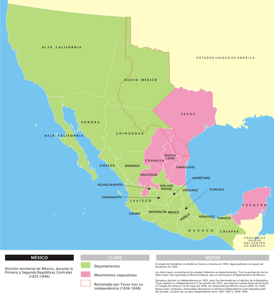
Description: Mapa de la organización territorial de México durante las Repúblicas Centralistas (1835-1846), con notas en español.
Title: México División Política-República Central
Credit: Own work
Author: Yavidaxiu
Permission: I, the copyright holder of this work, release this work into the public domain. This applies worldwide. In some countries this may not be legally possible; if so: I grant anyone the right to use this work for any purpose, without any conditions, unless such conditions are required by law.
Usage Terms: Public domain
License: Public domain
Attribution Required?: No
Image usage
The following page links to this image:

All content from Kiddle encyclopedia articles (including the article images and facts) can be freely used under Attribution-ShareAlike license, unless stated otherwise.