
Image: M4 motorway map animated
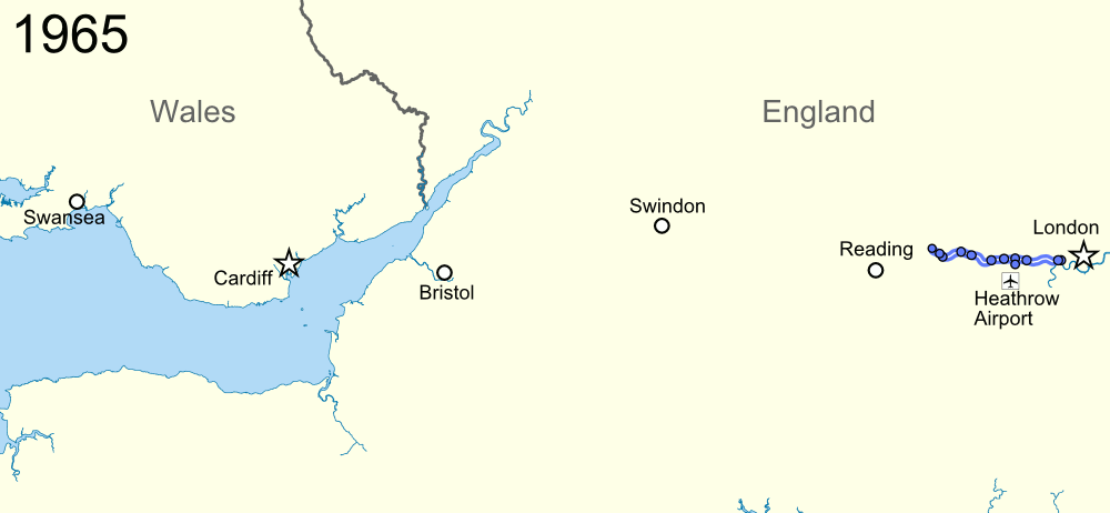
Description: Animated timeline of the development of the M4 motorway, with frames showing the extent open in 1965, 1970, 1975, 1980 and 1996. Equirectangular map projection on WGS 84 datum, with N/S stretched 160% Geographic limits: West: 4.25W East: 0.10W North: 52.10N South: 50.90N
Title: M4 motorway map animated
Credit: Ordnance Survey OpenData. Coastline and administrative boundaries from Boundary-Line product. Road data from Meridian 2 product.
Author: Nilfanion, created using Ordnance Survey data
Permission: This file is licensed under the Creative Commons Attribution-Share Alike 3.0 Unported license. Attribution: Contains Ordnance Survey data © Crown copyright and database right You are free: to share – to copy, distribute and transmit the work to remix – to adapt the work Under the following conditions: attribution – You must attribute the work in the manner specified by the author or licensor (but not in any way that suggests that they endorse you or your use of the work). share alike – If you alter, transform, or build upon this work, you may distribute the resulting work only under the same or similar license to this one. http://creativecommons.org/licenses/by-sa/3.0 CC BY-SA 3.0 Creative Commons Attribution-Share Alike 3.0 truetrue
Usage Terms: Creative Commons Attribution-Share Alike 3.0
License: CC BY-SA 3.0
License Link: http://creativecommons.org/licenses/by-sa/3.0
Attribution Required?: Yes
Image usage
There are no pages that link to this image.
