
Image: MODIS Map
Size of this preview: 800 × 400 pixels. Other resolutions: 320 × 160 pixels | 5,400 × 2,700 pixels.
Original image (5,400 × 2,700 pixels, file size: 11.84 MB, MIME type: image/jpeg)
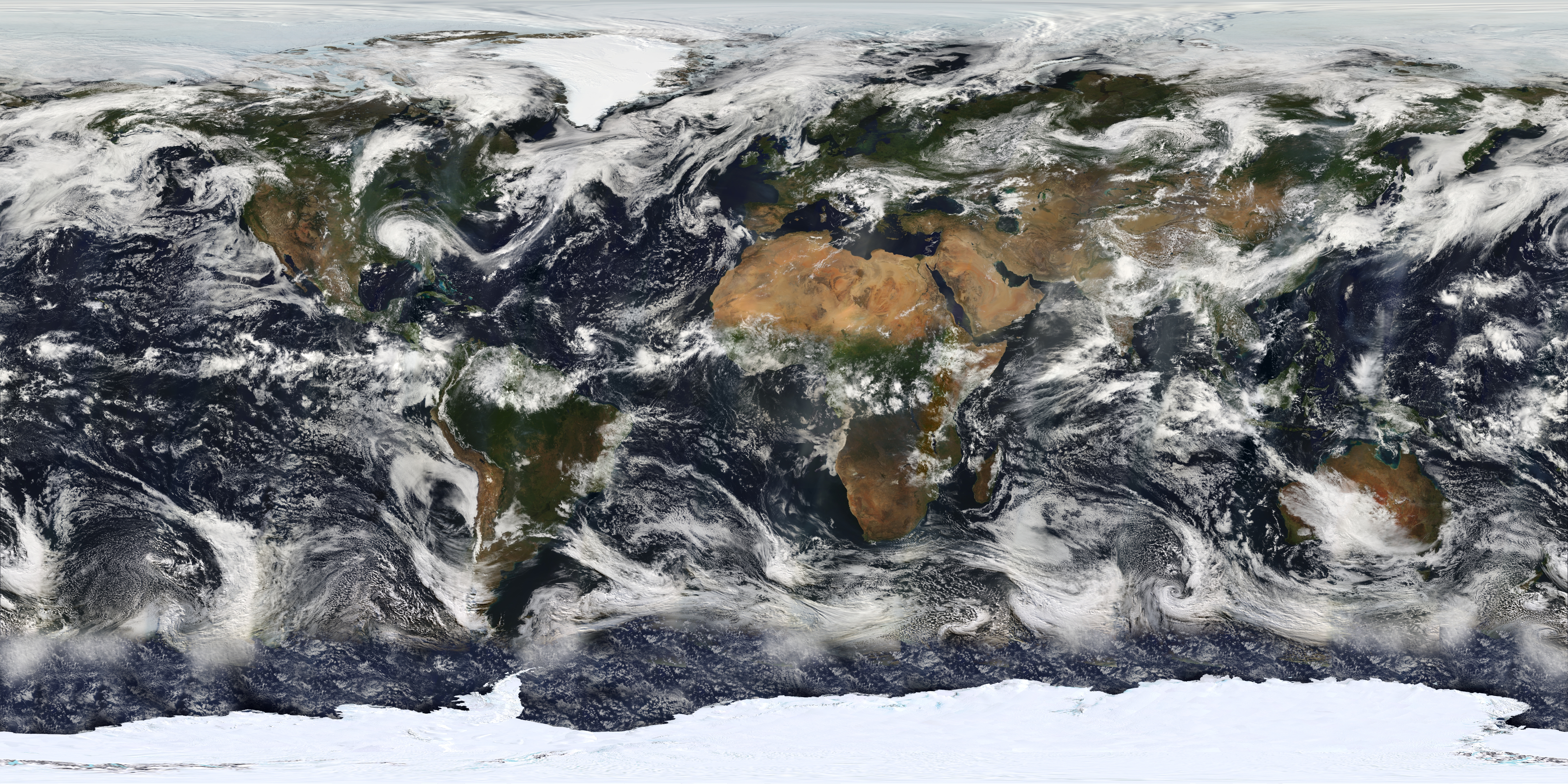
Description: This image is based largely on observations from the Moderate Resolution Imaging Spectroradiometer (MODIS) - a sensor aboard the Terra satellite - on July 11, 2005. Small gaps in MODIS' coverage between overpasses, as well as Antarctica (which is in polar darkness in July), have been filled in using GOES weather satellites and the latest version of the NASA Blue Marble. Hurricane Dennis can be seen moving inland over the Gulf Coast.
Title: MODIS Map
Credit: Earth's Vital Signs
Author: NASA
Usage Terms: Public domain
License: Public domain
Attribution Required?: No
Image usage
There are no pages that link to this image.

All content from Kiddle encyclopedia articles (including the article images and facts) can be freely used under Attribution-ShareAlike license, unless stated otherwise.