
Image: Macedonia ad400
Size of this preview: 624 × 599 pixels. Other resolutions: 250 × 240 pixels | 630 × 605 pixels.
Original image (630 × 605 pixels, file size: 416 KB, MIME type: image/png)
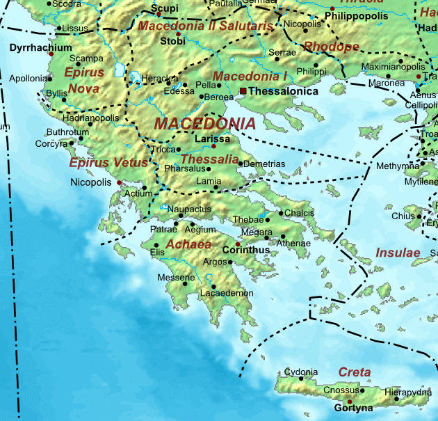
Description: Map of the ca. 400 AD, showing the administrative division into dioceses and provinces, as well as the major cities.
Title: Macedonia ad400
Credit: The_Roman_Empire_ca_400_AD.png
Author: The_Roman_Empire_ca_400_AD.png: Cplakidas derivative work: ChrisO (talk)
Usage Terms: Public domain
License: Public domain
Attribution Required?: No
Image usage
The following 2 pages link to this image:

All content from Kiddle encyclopedia articles (including the article images and facts) can be freely used under Attribution-ShareAlike license, unless stated otherwise.