
Image: Mackinac Island topographic map-en

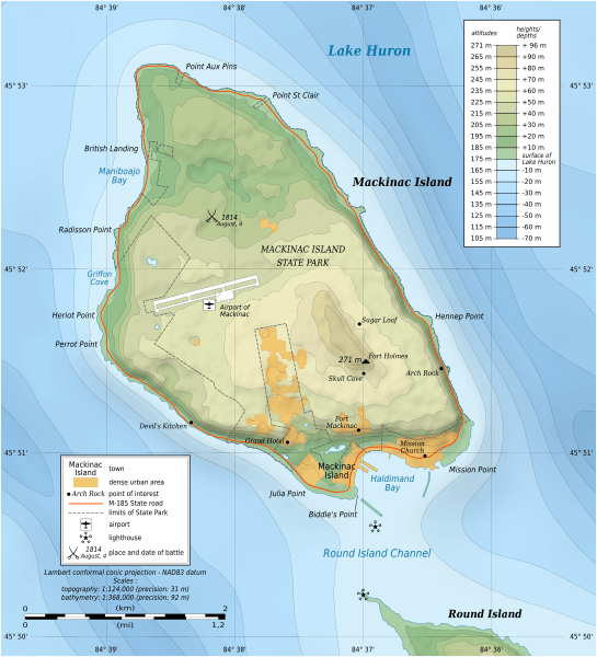
Description: Topographic map in English of Mackinac Island, Lake Huron, Michigan, USA. Note: The shaded relief is a raster image embedded in the SVG file.
Title: Mackinac Island topographic map-en
Credit: Own work Sources of data: NASA SRTM1v2 NGDC Great Lakes Bathymetry USGS 24k topographic maps Landsat7 ETM+ imagery Toponymy: map by James Faasen
Author: Eric Gaba (Sting - fr:Sting)
Permission: Attribution and Share-Alike required Any use of this map can be made as long as you credit me (Eric Gaba – Wikimedia Commons user: Sting) as the author and distribute the copies and derivative works under the same license(s) that the one(s) stated below. A message with a reply address would also be greatly appreciated.
Usage Terms: Creative Commons Attribution-Share Alike 3.0
License: CC BY-SA 3.0
License Link: http://creativecommons.org/licenses/by-sa/3.0
Attribution Required?: Yes
Image usage
