
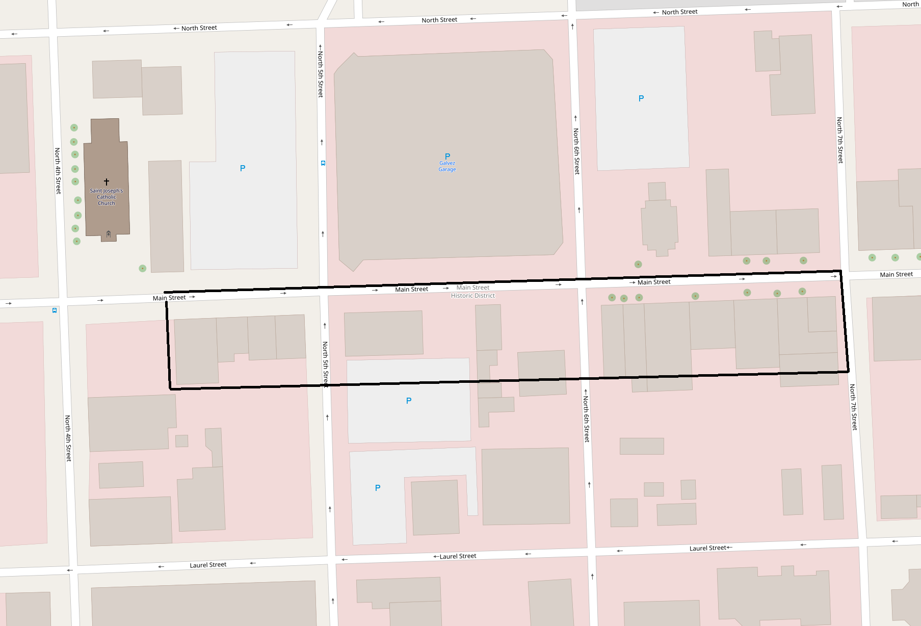
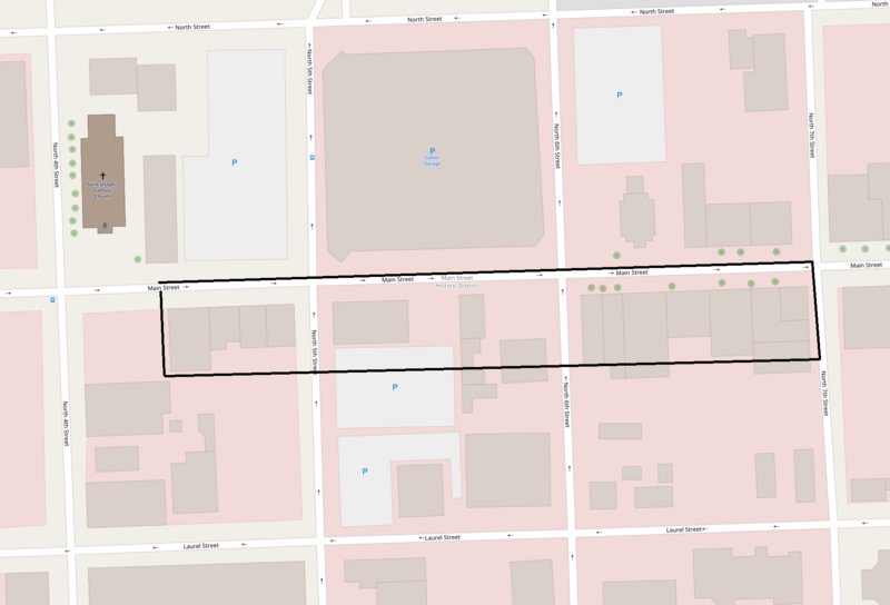
Image: Main Street Historic District, LA
Description: Map showing the boundaries of the Main Street Historic District, Louisiana, United States. The historic district is listed on the National Register of Historic Places. Boundaries are derived from the map attached to the district's National Register amended nomination form.
Title: Main Street Historic District, LA
Credit: Screenshot of OpenStreetMap's map of Main Street Historic District vicinity, with district boundary lines drawn by uploader
Author: OpenStreetMap editors (map), ProprioMe OW (district boundaries)
Permission: My work is public domain, and the original map is This file is licensed under the Creative Commons Attribution 2.0 Generic license. You are free: to share – to copy, distribute and transmit the work to remix – to adapt the work Under the following conditions: attribution – You must give appropriate credit, provide a link to the license, and indicate if changes were made. You may do so in any reasonable manner, but not in any way that suggests the licensor endorses you or your use. https://creativecommons.org/licenses/by/2.0 CC BY 2.0 Creative Commons Attribution 2.0 truetrue
Usage Terms: Creative Commons Attribution 2.0
License: CC BY 2.0
License Link: https://creativecommons.org/licenses/by/2.0
Attribution Required?: Yes
Image usage
The following page links to this image:
