
Image: Major US Aquifers by Rock Type
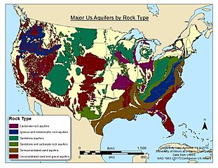
Size of this preview: 776 × 600 pixels. Other resolutions: 311 × 240 pixels | 1,056 × 816 pixels.
Original image (1,056 × 816 pixels, file size: 636 KB, MIME type: image/jpeg)
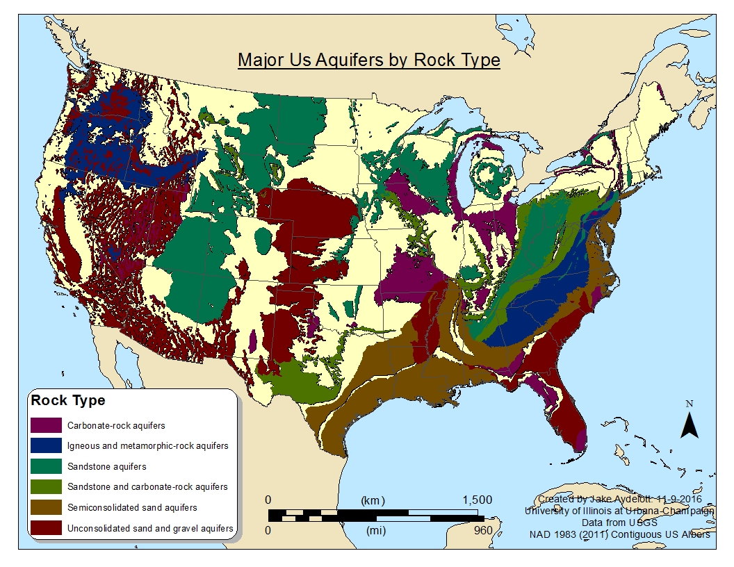
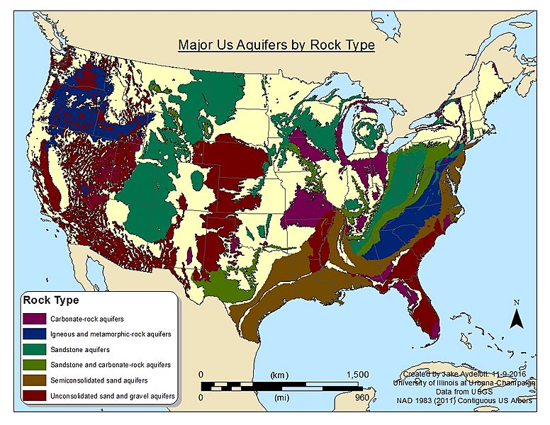
Description: This map show major aquifers in the contiguous US by what type of material they flow through such as sandstone or unconsolidated material. The data for this map comes from an USGS survey that took place between 2002 and 2003.
Title: Major US Aquifers by Rock Type
Credit: Own work
Author: Jesha17
Usage Terms: Creative Commons Attribution-Share Alike 4.0
License: CC BY-SA 4.0
License Link: http://creativecommons.org/licenses/by-sa/4.0
Attribution Required?: Yes
Image usage
The following 2 pages link to this image:

All content from Kiddle encyclopedia articles (including the article images and facts) can be freely used under Attribution-ShareAlike license, unless stated otherwise.