
Image: Mali regions map

Size of this preview: 632 × 600 pixels. Other resolutions: 253 × 240 pixels | 2,108 × 2,000 pixels.
Original image (2,108 × 2,000 pixels, file size: 650 KB, MIME type: image/png)
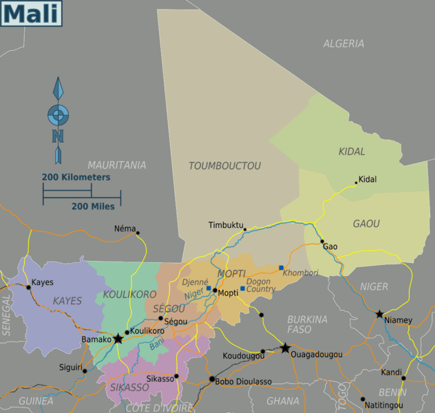
Description: Mali regions map for use on Wikivoyage, English version
Title: Mali regions map
Credit: Own work based on the UN map of Mali and [1] UN Maps derived This image is derived from products of the United Nations Cartographic Section. Modified versions of UNCS maps may be used provided that the UN name and reference number do not appear on any modified version, and a link to the original map is provided. UN Maps derived
Author: Peter Fitzgerald
Usage Terms: Creative Commons Attribution-Share Alike 3.0
License: CC BY-SA 3.0
License Link: https://creativecommons.org/licenses/by-sa/3.0
Attribution Required?: Yes
Image usage
There are no pages that link to this image.

All content from Kiddle encyclopedia articles (including the article images and facts) can be freely used under Attribution-ShareAlike license, unless stated otherwise.