
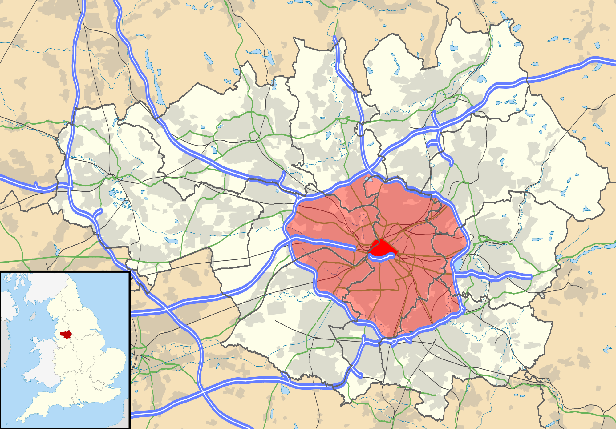
Image: Manchester Congestion Charge
Description: Map of Greater Manchester, UK with the following information shown: Administrative borders Coastline, lakes and rivers Roads and railways Urban areas The two proposed congestion charging zones for Greater Manchester (in red). The data includes both primary routes and railway lines. Equirectangular map projection on WGS 84 datum, with N/S stretched 165% Geographic limits: West: 2.80W East: 1.90W North: 53.70N South: 53.32N
Title: Manchester Congestion Charge
Credit: Derivative work of: File:Greater Manchester UK location map 2.svg, by Nilfanion, created using Ordnance Survey data
Author: jza84
Usage Terms: Creative Commons Attribution-Share Alike 3.0
License: CC BY-SA 3.0
License Link: https://creativecommons.org/licenses/by-sa/3.0
Attribution Required?: Yes
Image usage
The following page links to this image:
