
Image: Manchester London Road and Mayfield map 1915 6inch
No higher resolution available.
Manchester_London_Road_and_Mayfield_map_1915_6inch.gif (598 × 411 pixels, file size: 216 KB, MIME type: image/gif)
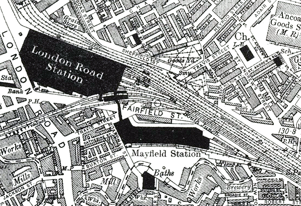
Description: Manchester London Road station shown on a 6-inch scale map from 1915. The close proximity of Manchester Mayfield station is clearly illustrated. The covered footbridge that linked the two stations is also shown.
Title: Manchester London Road and Mayfield map 1915 6inch
Credit: Disused Stations
Author: Ordnance Survey
Usage Terms: Public domain
License: Public domain
Attribution Required?: No
Image usage
The following page links to this image:

All content from Kiddle encyclopedia articles (including the article images and facts) can be freely used under Attribution-ShareAlike license, unless stated otherwise.