
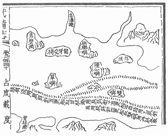
Image: Mao Kun map - Langkawi, Kedah, Penang
No higher resolution available.
Mao_Kun_map_-_Langkawi,_Kedah,_Penang.png (656 × 541 pixels, file size: 213 KB, MIME type: image/png)
Description: Mao Kun map showing the island of Langkawi (龍牙交椅), Kedah river estuary (吉達港), Penang island (梹榔嶼) and Pulau Sembilan (九州)
Title: Mao Kun map - Langkawi, Kedah, Penang
Credit: Scanned from The Golden Khersonese by Paul Wheatley, originally from Wubei Zhi, a 17th century work with maps dated to Zheng He voyages
Author: Mao Yuanyi and unknown cartographer
Usage Terms: Public domain
License: Public domain
Attribution Required?: No
Image usage
The following page links to this image:

All content from Kiddle encyclopedia articles (including the article images and facts) can be freely used under Attribution-ShareAlike license, unless stated otherwise.