
Image: Map-Germany-1945

Size of this PNG preview of this SVG file: 706 × 600 pixels. Other resolution: 283 × 240 pixels.
Original image (SVG file, nominally 3,492 × 2,966 pixels, file size: 726 KB)
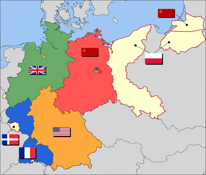
Description: Occupation zone borders in Germany, 1947. The territories east of the Oder-Neisse line, under Polish and Soviet administration/annexation, are shown as cream as is the likewise detached Saar protectorate. Berlin is the multinational area within the Soviet zone.
Author: User:52 Pickup
Usage Terms: Creative Commons Attribution-Share Alike 3.0
License: CC-BY-SA-3.0
License Link: http://creativecommons.org/licenses/by-sa/3.0/
Attribution Required?: Yes
Image usage
The following 5 pages link to this image:

All content from Kiddle encyclopedia articles (including the article images and facts) can be freely used under Attribution-ShareAlike license, unless stated otherwise.