Image: Map-belgian-congo

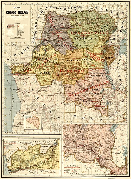
Description: "Little is known about the actual cartographer and engraver of this map, Léon de Moor. More is known about the publishing house, J. Lebègue and Co. The firm published many geographical documents, including maps and travel accounts. In 1896, when this map was published, the Belgian Congo–known as the Congo Free State–was actually a personal possession of King Leopold II and not an official Belgian colony. The king was engaged in a vigorous publicity campaign aimed at convincing the other European powers to recognize the legitimacy of his rule, a difficult task in view of the notorious brutality of his administration in Africa. A close look at the legend of the map reveals J. Lebègue and Co. as the publisher, but the “Office of Publicity” as its editor. The map includes detailed insets of the provinces of Leopoldville in the lower Congo and of Elisabethville in Katanga."
Title: Map-belgian-congo
Credit: Carte du Congo Belge / Library of Congress
Author: Bureau de la publicité, J. Lebègue & Cie, Bruxelles
Usage Terms: Public domain
License: Public domain
Attribution Required?: No
Image usage
The following page links to this image:

