
Image: MapRiversSoutheastCornwallUK
Size of this preview: 571 × 600 pixels. Other resolutions: 229 × 240 pixels | 600 × 630 pixels.
Original image (600 × 630 pixels, file size: 30 KB, MIME type: image/gif)
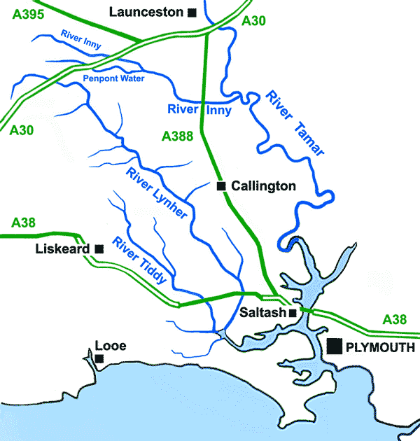
Description: A sketch map of the Rivers of southeast Cornwall, United Kingdom
Title: MapRiversSoutheastCornwallUK
Credit: Own work
Author: Andy F
Usage Terms: Creative Commons Attribution 3.0
License: CC BY 3.0
License Link: http://creativecommons.org/licenses/by/3.0
Attribution Required?: Yes
Image usage
The following 4 pages link to this image:

All content from Kiddle encyclopedia articles (including the article images and facts) can be freely used under Attribution-ShareAlike license, unless stated otherwise.