
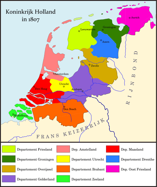
Image: Map Kingdom of Holland 1807-nl

Size of this PNG preview of this SVG file: 505 × 600 pixels. Other resolution: 202 × 240 pixels.
Original image (SVG file, nominally 1,902 × 2,258 pixels, file size: 619 KB)
Description: svg version of File:1807koninkrijk holland.jpg based on H. Hettema jr. (ed.), Groote Historische Schoolatlas ten gebruike bij het onderwijs in de vaderlandsche en algemene geschiedenis (no. 7), 1920
Title: Map Kingdom of Holland 1807-nl
Credit: Own work
Author: Joostik
Usage Terms: Creative Commons Attribution-Share Alike 3.0
License: CC BY-SA 3.0
License Link: http://creativecommons.org/licenses/by-sa/3.0
Attribution Required?: Yes
Image usage
The following page links to this image:

All content from Kiddle encyclopedia articles (including the article images and facts) can be freely used under Attribution-ShareAlike license, unless stated otherwise.