
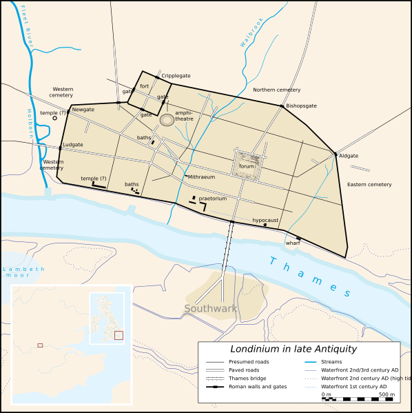
Image: Map Londinium 400 AD-en

Size of this PNG preview of this SVG file: 598 × 599 pixels. Other resolution: 240 × 240 pixels.
Original image (SVG file, nominally 996 × 998 pixels, file size: 742 KB)
Description: An anachronistic map of Roman London (Londinium) in late Antiquity (2nd-5th c.)
Title: Map Londinium 400 AD-en
Credit: http://upload.wikimedia.org/wikipedia/commons/5/59/Map_Londinium_400_AD-de.svg
Author: Fremantleboy, Drallim (translation)
Usage Terms: Creative Commons Attribution 2.5
License: CC BY 2.5
License Link: http://creativecommons.org/licenses/by/2.5
Attribution Required?: Yes
Image usage
The following page links to this image:

All content from Kiddle encyclopedia articles (including the article images and facts) can be freely used under Attribution-ShareAlike license, unless stated otherwise.