
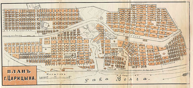
Image: Map Tsaritsyn 1909

Size of this preview: 800 × 367 pixels. Other resolutions: 320 × 147 pixels | 9,274 × 4,252 pixels.
Original image (9,274 × 4,252 pixels, file size: 1.55 MB, MIME type: image/jpeg)
Description: Map of Tsaritsyn in 1909 (present day Volgograd).
Title: Map Tsaritsyn 1909
Credit: Unknown
Author: Unknown
Permission: PD-old
Usage Terms: Public domain
License: Public domain
Attribution Required?: No
Image usage
There are no pages that link to this image.

All content from Kiddle encyclopedia articles (including the article images and facts) can be freely used under Attribution-ShareAlike license, unless stated otherwise.