
Image: Map elk chase kansas
No higher resolution available.
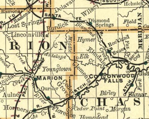
Map_elk_chase_kansas.jpg (499 × 397 pixels, file size: 63 KB, MIME type: image/jpeg)
Description: Part of a map of Kansas. Showing the ghost town Elk on the border between Chase County and Marion County. Image from an 1893 Map.
Title: Map elk chase kansas
Credit: http://alabamamaps.ua.edu/historicalmaps/us_states/kansas/index.html
Author: Chicago: Rand Mcnally and Company's Enlarged Business Atlas and Shippers
Usage Terms: Public domain
License: Public domain
Attribution Required?: No
Image usage
The following 16 pages link to this image:

All content from Kiddle encyclopedia articles (including the article images and facts) can be freely used under Attribution-ShareAlike license, unless stated otherwise.