
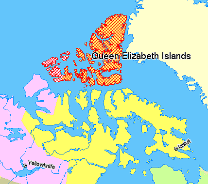
Image: Map indicating the Queen Elizabeth (or Parry) Islands, northern Canada
No higher resolution available.
Map_indicating_the_Queen_Elizabeth_(or_Parry)_Islands,_northern_Canada.png (428 × 380 pixels, file size: 66 KB, MIME type: image/png)
Title: Map indicating the Queen Elizabeth (or Parry) Islands, northern Canada
Usage Terms: Copyrighted free use
License: Copyrighted free use
License Link: //commons.wikimedia.org/wiki/File:Map_indicating_the_Queen_Elizabeth_(or_Parry)_Islands,_northern_Canada.png
Image usage
The following 3 pages link to this image:

All content from Kiddle encyclopedia articles (including the article images and facts) can be freely used under Attribution-ShareAlike license, unless stated otherwise.
_Islands,_northern_Canada.png)