
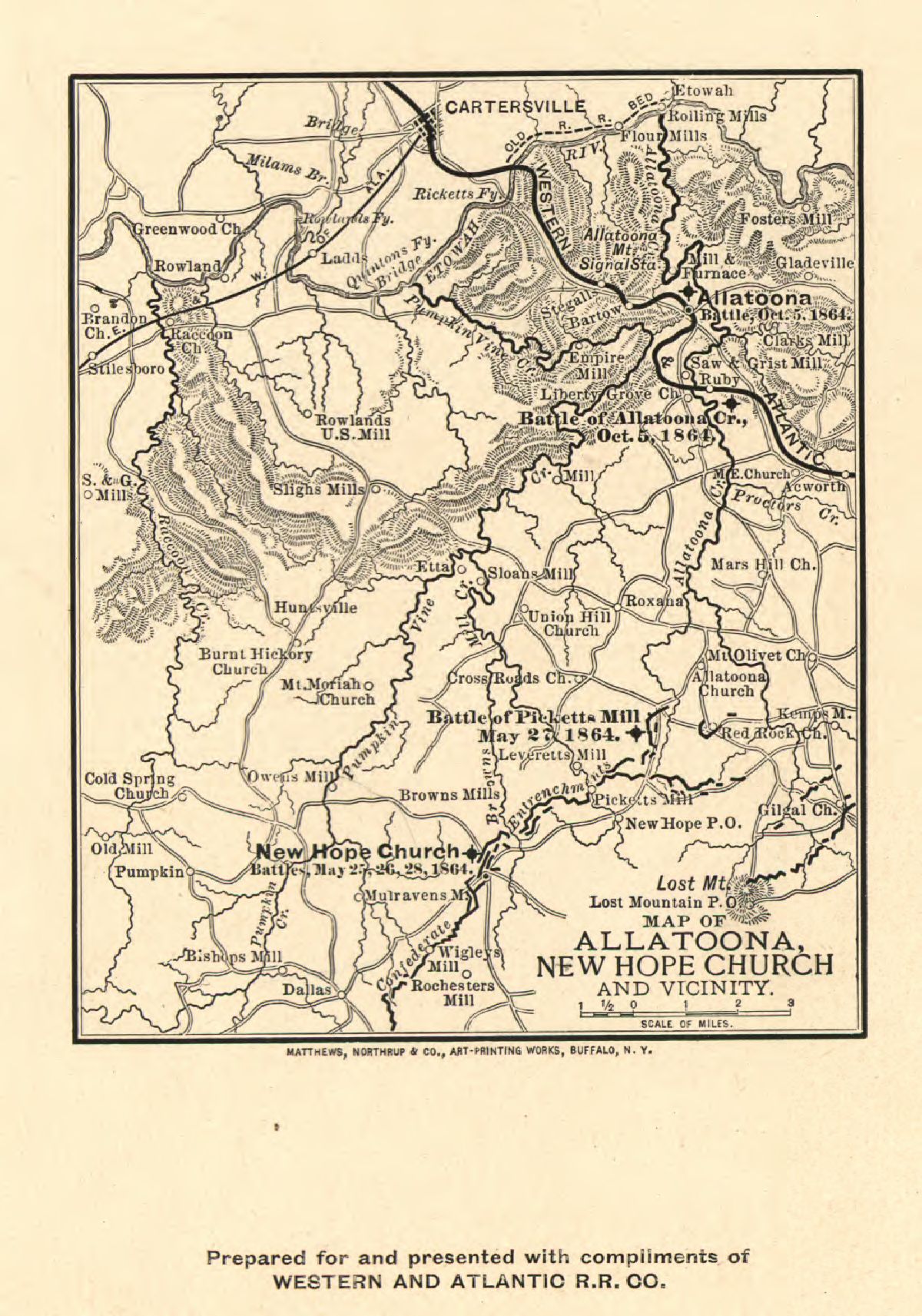
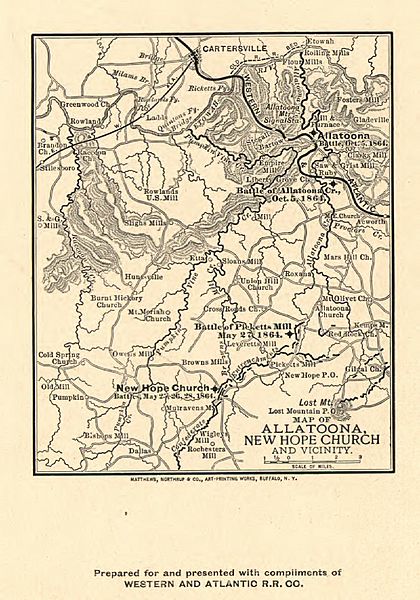
Image: Map of Allatoona, New Hope Church and vicinity. LOC 99447162
Description: Scale ca. 1:280,000. LC Civil War Maps (2nd ed.), 132.5 Shows location of battles of Allatoona, Allatoona Creek, Picketts Mill, and New Hope Church, roads, railroads, Confederate entrenchments, towns, drainage, and relief by hachures. Description derived from published bibliography. Available also through the Library of Congress web site as raster image.
Title: Map of Allatoona, New Hope Church and vicinity. LOC 99447162
Credit: https://www.loc.gov/item/99447162/
Author: Western And Atlantic Railroad Company
Permission: This map is available from the United States Library of Congress's Geography & Map Division under the digital ID g3923b.cw0132500. This tag does not indicate the copyright status of the attached work. A normal copyright tag is still required. See Commons:Licensing for more information.
Usage Terms: Public domain
License: Public domain
Attribution Required?: No
Image usage
The following page links to this image:
