
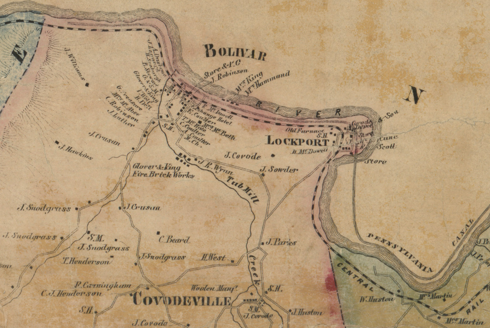
Image: Map of Bolivar and Lockport, Pennsylvania, from 1857 Westmoreland County Map by William J Barker
Size of this preview: 800 × 536 pixels. Other resolutions: 320 × 214 pixels | 1,568 × 1,050 pixels.
Original image (1,568 × 1,050 pixels, file size: 387 KB, MIME type: image/jpeg)
Description: Map of Bolivar and Lockport, Pennsylvania, taken from 1857 William J. Barker map of Westmoreland County available at the Library of Congress website
Title: Map of Bolivar and Lockport, Pennsylvania, from 1857 Westmoreland County Map by William J Barker
Credit: https://www.loc.gov/item/2012592226/
Author: William J. Barker
Usage Terms: Public domain
License: Public domain
Attribution Required?: No
Image usage
The following page links to this image:

All content from Kiddle encyclopedia articles (including the article images and facts) can be freely used under Attribution-ShareAlike license, unless stated otherwise.