
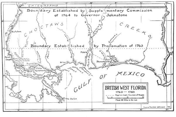
Image: Map of British West Florida showing 1763 and 1764 boundaries
No higher resolution available.
Map_of_British_West_Florida_showing_1763_and_1764_boundaries.jpg (600 × 398 pixels, file size: 45 KB, MIME type: image/jpeg)
Description: Map of West Florida. 1942(?) Black & white photoprint, 8 x 10 in. State Archives of Florida, Florida Memory. <https://www.floridamemory.com/items/show/35189>, accessed 29 January 2016. See British West Florida
Title: Map of British West Florida showing 1763 and 1764 boundaries
Credit: http://www.floridamemory.com/items/show/35189
Author: L. P. Johnson
Usage Terms: Public domain
License: Public domain
Attribution Required?: No
Image usage
The following page links to this image:

All content from Kiddle encyclopedia articles (including the article images and facts) can be freely used under Attribution-ShareAlike license, unless stated otherwise.