
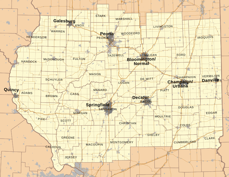
Image: Map of Central Illinois

Size of this PNG preview of this SVG file: 776 × 600 pixels. Other resolution: 311 × 240 pixels.
Original image (SVG file, nominally 1,940 × 1,500 pixels, file size: 5.47 MB)
Description: Map of central Illinois with major cities, county boundaries, township boundaries, municipality boundaries, and major highways. Data is from US Census TIGER website and Illinois Natural Resources Geospatial Data Clearinghouse website.
Title: Map of Central Illinois
Credit: Own work
Author: Isipeoria
Usage Terms: Creative Commons Attribution-Share Alike 3.0
License: CC BY-SA 3.0
License Link: http://creativecommons.org/licenses/by-sa/3.0
Attribution Required?: Yes
Image usage
The following page links to this image:

All content from Kiddle encyclopedia articles (including the article images and facts) can be freely used under Attribution-ShareAlike license, unless stated otherwise.