
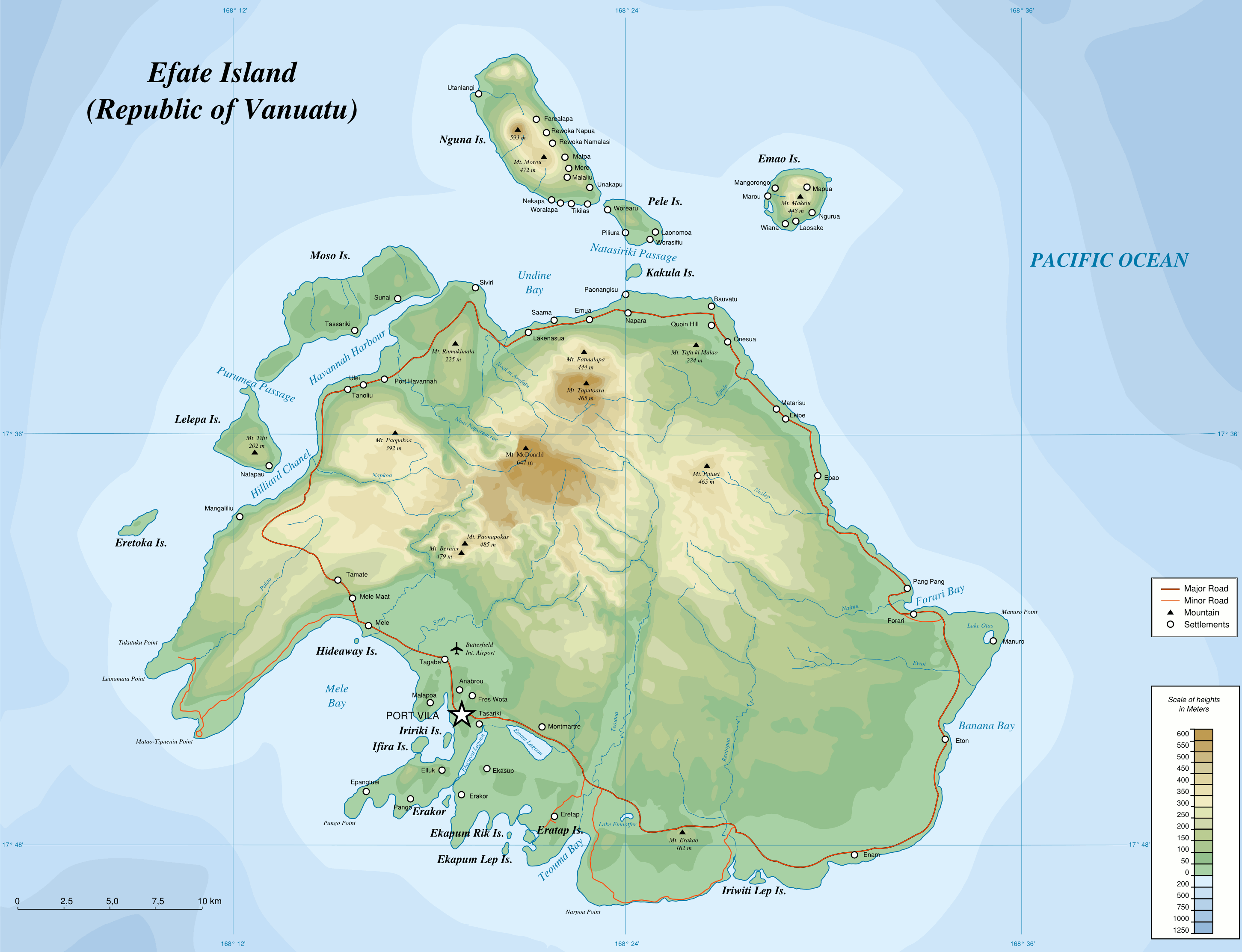
Image: Map of Efate Island EN
Description: Topographic Map of Efate Island (Vanuatu) - PNG version
Title: Map of Efate Island EN
Credit: Own work. Data sources : Background map : NASA Shuttle Radar Topography Mission (SRTM3 v.2) (public domain) Softwares used : NASA datas edited with 3DEM from Visualization Software LLC Vectorized with Inkscape The Gimp ; Creation Map Tutorial (in french) from Sting (thanks to him) Slight enhancement of features in this english version made possible by http://www.avisvanuatu.com/images/efate.jpg Others : UTM map projection WGS84 geodetic system
Author: Переход Артур, english translation: Hk kng
Permission: CC-BY-SA
Usage Terms: Creative Commons Attribution-Share Alike 3.0
License: CC BY-SA 3.0
License Link: http://creativecommons.org/licenses/by-sa/3.0
Attribution Required?: Yes
Image usage
The following page links to this image:
