
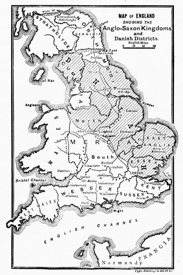
Image: Map of England Showing the Anglo-Saxon Kingdoms and Danish Districts
Size of this preview: 398 × 600 pixels. Other resolutions: 159 × 240 pixels | 600 × 904 pixels.
Original image (600 × 904 pixels, file size: 136 KB, MIME type: image/jpeg)
Description: Map of England Showing the Anglo-Saxon Kingdoms and Danish Districts - from Cassell's History of England, Vol. I - anonymous author and artists
Title: Map of England Showing the Anglo-Saxon Kingdoms and Danish Districts
Credit: http://www.gutenberg.org/ebooks/48451
Author: Anonymous
Usage Terms: Public domain
License: Public domain
Attribution Required?: No
Image usage
There are no pages that link to this image.

All content from Kiddle encyclopedia articles (including the article images and facts) can be freely used under Attribution-ShareAlike license, unless stated otherwise.