
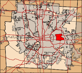
Image: Map of Franklin County, Ohio highlighting Whitehall

Size of this PNG preview of this SVG file: 673 × 600 pixels. Other resolution: 269 × 240 pixels.
Original image (SVG file, nominally 1,669 × 1,487 pixels, file size: 2.51 MB)
Description: Franklin County, Ohio with the city of Whitehall highlighted
Title: Map of Franklin County, Ohio highlighting Whitehall
Credit: Own work, TIGER data
Author: Ibagli
Usage Terms: Creative Commons Zero, Public Domain Dedication
License: CC0
License Link: http://creativecommons.org/publicdomain/zero/1.0/deed.en
Attribution Required?: No
Image usage
There are no pages that link to this image.

All content from Kiddle encyclopedia articles (including the article images and facts) can be freely used under Attribution-ShareAlike license, unless stated otherwise.