
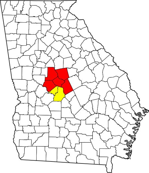
Image: Map of Georgia highlighting Macon-Warner Robins-Fort Valley CSA

Description: Locator map of the Macon-Warner Robins-Fort Valley Combined Statistical Area in the central part of the U.S. state of Georgia. The two components of the CSA are colored separately: Macon Metropolitan Statistical Area: red Warner Robins Metropolitan Statistical Area: yellow
Title: Map of Georgia highlighting Macon-Warner Robins-Fort Valley CSA
Credit: Own work, updated version of https://commons.wikimedia.org/wiki/File:Macon-Warner_Robins-Fort_Valley_CSA.png with current CSA counties using https://commons.wikimedia.org/wiki/File:Map_of_Georgia_highlighting_Houston_County.svg as a base.
Author: Lordsutch
Usage Terms: Creative Commons Attribution-Share Alike 4.0
License: CC BY-SA 4.0
License Link: https://creativecommons.org/licenses/by-sa/4.0
Attribution Required?: Yes
Image usage
The following page links to this image:
