
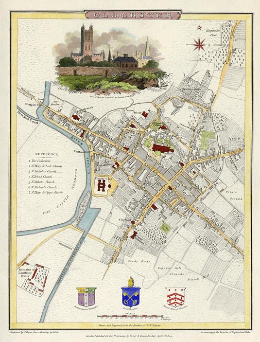
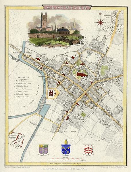
Image: Map of Gloucester in 1805 engraved by J.Roper from a drawing by G.Cole
Size of this preview: 456 × 599 pixels. Other resolutions: 183 × 240 pixels | 535 × 703 pixels.
Original image (535 × 703 pixels, file size: 95 KB, MIME type: image/jpeg)
Description: Street map of Gloucester
Title: Map of Gloucester in 1805 engraved by J.Roper from a drawing by G.Cole
Credit: ancestryimages.com free image archive
Author: J. Roper, engraver
Usage Terms: Public domain
License: Public domain
Attribution Required?: No
Image usage
The following page links to this image:

All content from Kiddle encyclopedia articles (including the article images and facts) can be freely used under Attribution-ShareAlike license, unless stated otherwise.