
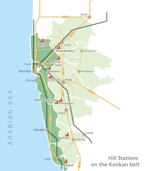
Image: Map of Hill-stations on Konkan belt

Size of this preview: 506 × 600 pixels. Other resolutions: 202 × 240 pixels | 584 × 692 pixels.
Original image (584 × 692 pixels, file size: 87 KB, MIME type: image/png)
Description: This is a schematic map of the Konkan belt (Maharashtra) with the hill stations plotted on it and how they are connected with roadways and railways.
Title: Map of Hill-stations on Konkan belt
Credit: Own work
Author: Kinnari
Usage Terms: Creative Commons Attribution-Share Alike 3.0
License: CC BY-SA 3.0
License Link: http://creativecommons.org/licenses/by-sa/3.0
Attribution Required?: Yes
Image usage
The following page links to this image:

All content from Kiddle encyclopedia articles (including the article images and facts) can be freely used under Attribution-ShareAlike license, unless stated otherwise.