
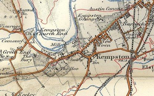
Image: Map of Kempston, Bedfordshire in 1908
No higher resolution available.
Map_of_Kempston,_Bedfordshire_in_1908.JPG (500 × 314 pixels, file size: 68 KB, MIME type: image/jpeg)
Description: This map of Kempston in 1908 is centred on Kempston Urban District, which then had a population of just over 5,000. Kempston Rural District extends off the map to the north, west and south. A small part of Bedford appears top right. The bottom right is in the parish of Elstow and the land north of the river is in the parish of Biddenham.
Title: Map of Kempston, Bedfordshire in 1908
Usage Terms: Public domain
License: Public domain
Attribution Required?: No
Image usage
The following page links to this image:

All content from Kiddle encyclopedia articles (including the article images and facts) can be freely used under Attribution-ShareAlike license, unless stated otherwise.