
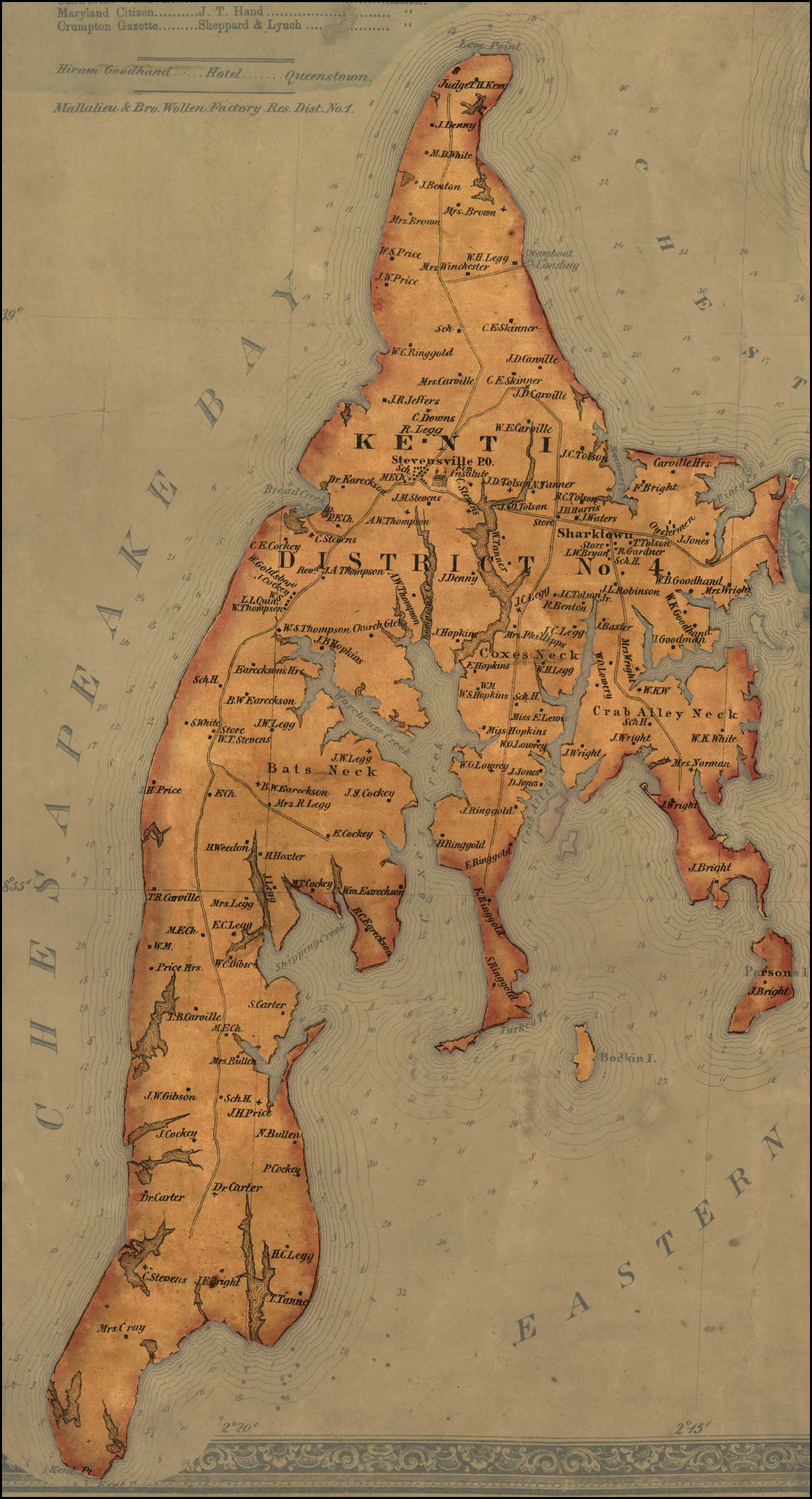
Image: Map of Kent Island -1866
Size of this preview: 325 × 600 pixels. Other resolutions: 130 × 240 pixels | 1,588 × 2,930 pixels.
Original image (1,588 × 2,930 pixels, file size: 428 KB, MIME type: image/jpeg)
Description: J. G. Stong's Map of Queen Anne's County, 1866, Maryland State Archives SC 5080-1
Title: Map of Kent Island -1866
Credit: http://slavery.msa.maryland.gov/images/maps/qad5.jpg
Author: J. G. Strong
Usage Terms: Public domain
License: Public domain
Attribution Required?: No
Image usage
The following page links to this image:

All content from Kiddle encyclopedia articles (including the article images and facts) can be freely used under Attribution-ShareAlike license, unless stated otherwise.