
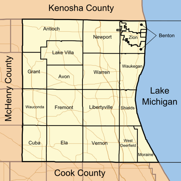
Image: Map of Lake County Illinois showing townships

Size of this preview: 598 × 599 pixels. Other resolutions: 239 × 240 pixels | 922 × 924 pixels.
Original image (922 × 924 pixels, file size: 169 KB, MIME type: image/png)
Description: This is a map which shows the borders of Lake County, Illinois and the borders of its townships.
Title: Map of Lake County Illinois showing townships
Credit: Own work
Author: TheCuriousGnome
Usage Terms: Public domain
License: Public domain
Attribution Required?: No
Image usage
The following page links to this image:

All content from Kiddle encyclopedia articles (including the article images and facts) can be freely used under Attribution-ShareAlike license, unless stated otherwise.