
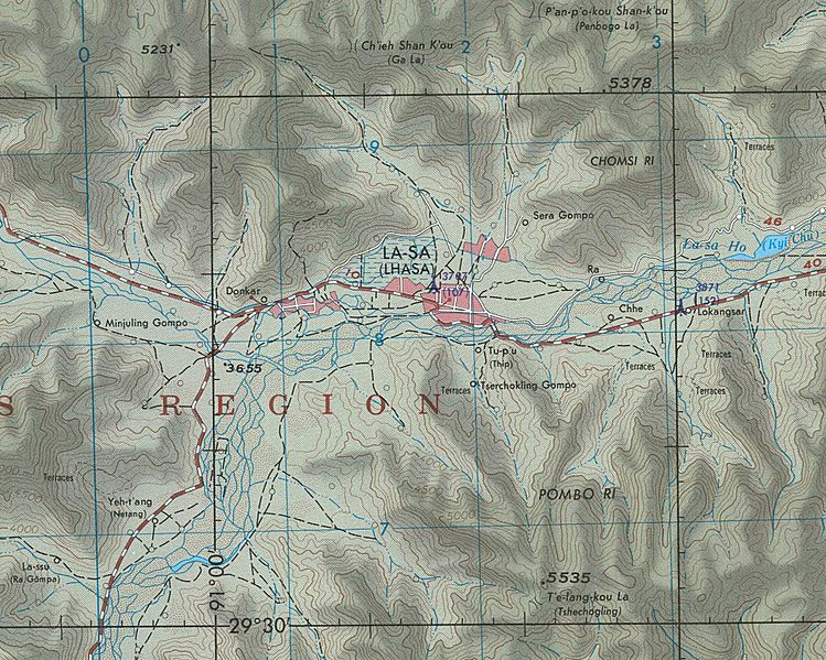
Image: Map of Lhasa, Tibet Autonomous Region in 1973 detail, from- NH-46-9 Lasa Tibet (cropped)

Size of this preview: 749 × 599 pixels. Other resolutions: 300 × 240 pixels | 2,034 × 1,628 pixels.
Original image (2,034 × 1,628 pixels, file size: 618 KB, MIME type: image/jpeg)
Description: NH-46-9 Lasa Tibet
Title: Map of Lhasa, Tibet Autonomous Region in 1973 detail, from- NH-46-9 Lasa Tibet (cropped)
Credit: People's Association for Himalaya Area Research
Author: Defense Mapping Agency, 1973
Usage Terms: Public domain
License: Public domain
Attribution Required?: No
Image usage
The following page links to this image:

All content from Kiddle encyclopedia articles (including the article images and facts) can be freely used under Attribution-ShareAlike license, unless stated otherwise.
.jpg)