
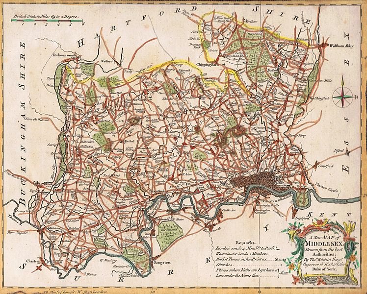
Image: Map of Middlesex, drawn by Thomas Kitchin, geographer, 1769

Size of this preview: 748 × 600 pixels. Other resolutions: 299 × 240 pixels | 11,813 × 9,471 pixels.
Original image (11,813 × 9,471 pixels, file size: 20.59 MB, MIME type: image/jpeg)
Description: Scan (by me, R. de Salis, Rodolph (talk) 23:59, 9 March 2016 (UTC)) of a map of Middlesex, drawn by Thomas Kitchin, geographer, 1769.
Title: Map of Middlesex, drawn by Thomas Kitchin, geographer, 1769
Credit: Transferred from en.wikipedia to Commons. (Original text: Original publication: GB Immediate source: Sammlung Fane de Salis)
Author: Thomas Kitchin (Life time: 1718–1784)
Usage Terms: Public domain
License: Public domain
Attribution Required?: No
Image usage
The following 3 pages link to this image:

All content from Kiddle encyclopedia articles (including the article images and facts) can be freely used under Attribution-ShareAlike license, unless stated otherwise.