
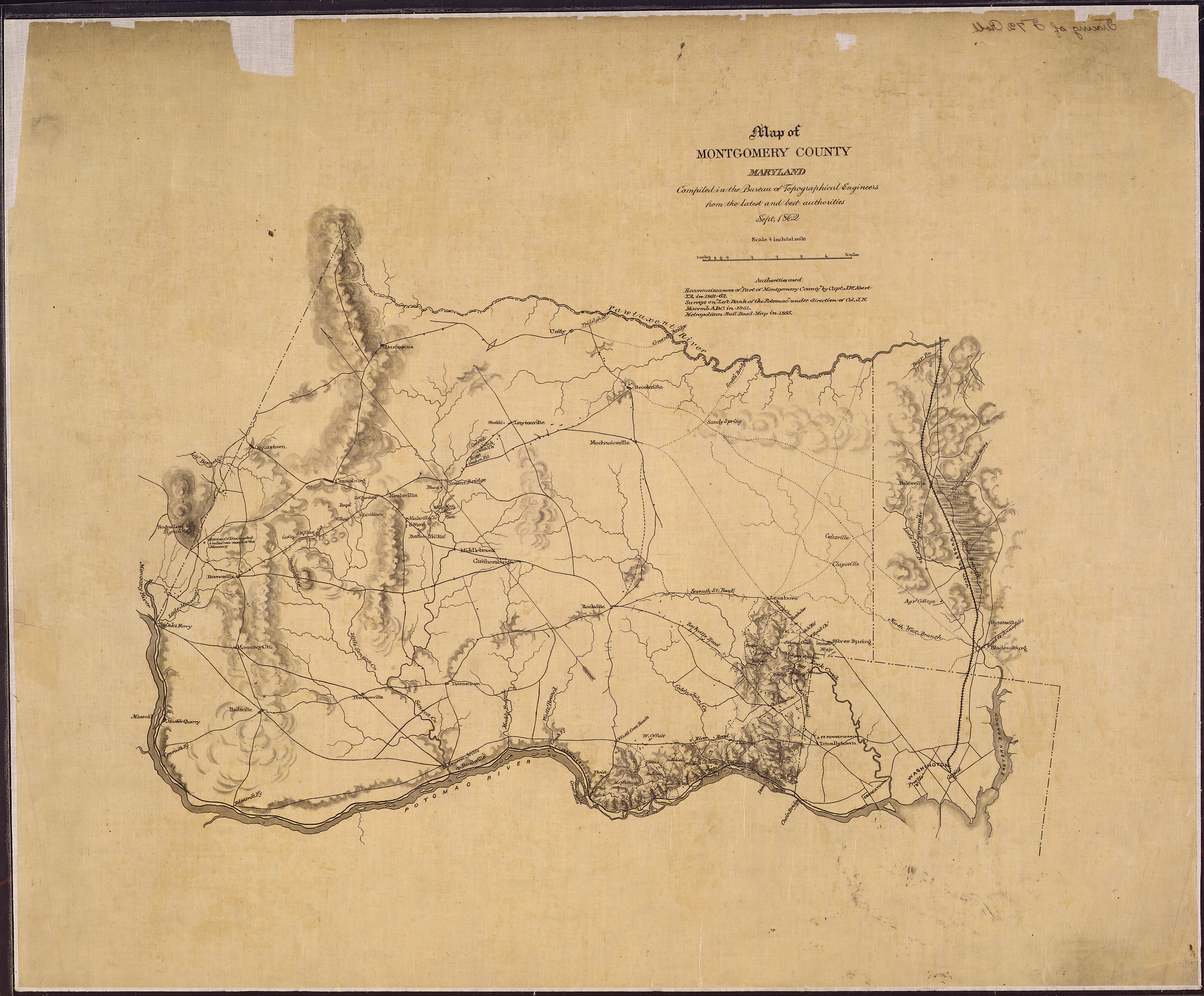
Image: Map of Montgomery County, Maryland. Compiled in the Bureau of Topographical Engineers from the latest and best... - NARA - 305573
Size of this preview: 725 × 600 pixels. Other resolutions: 290 × 240 pixels | 5,449 × 4,507 pixels.
Original image (5,449 × 4,507 pixels, file size: 7.14 MB, MIME type: image/jpeg)
Title: Map of Montgomery County, Maryland. Compiled in the Bureau of Topographical Engineers from the latest and best authorities, Sept. 1862.
Credit: U.S. National Archives and Records Administration
Author: Unknown or not provided
Usage Terms: Public domain
License: Public domain
Attribution Required?: No
Image usage
The following page links to this image:

All content from Kiddle encyclopedia articles (including the article images and facts) can be freely used under Attribution-ShareAlike license, unless stated otherwise.