
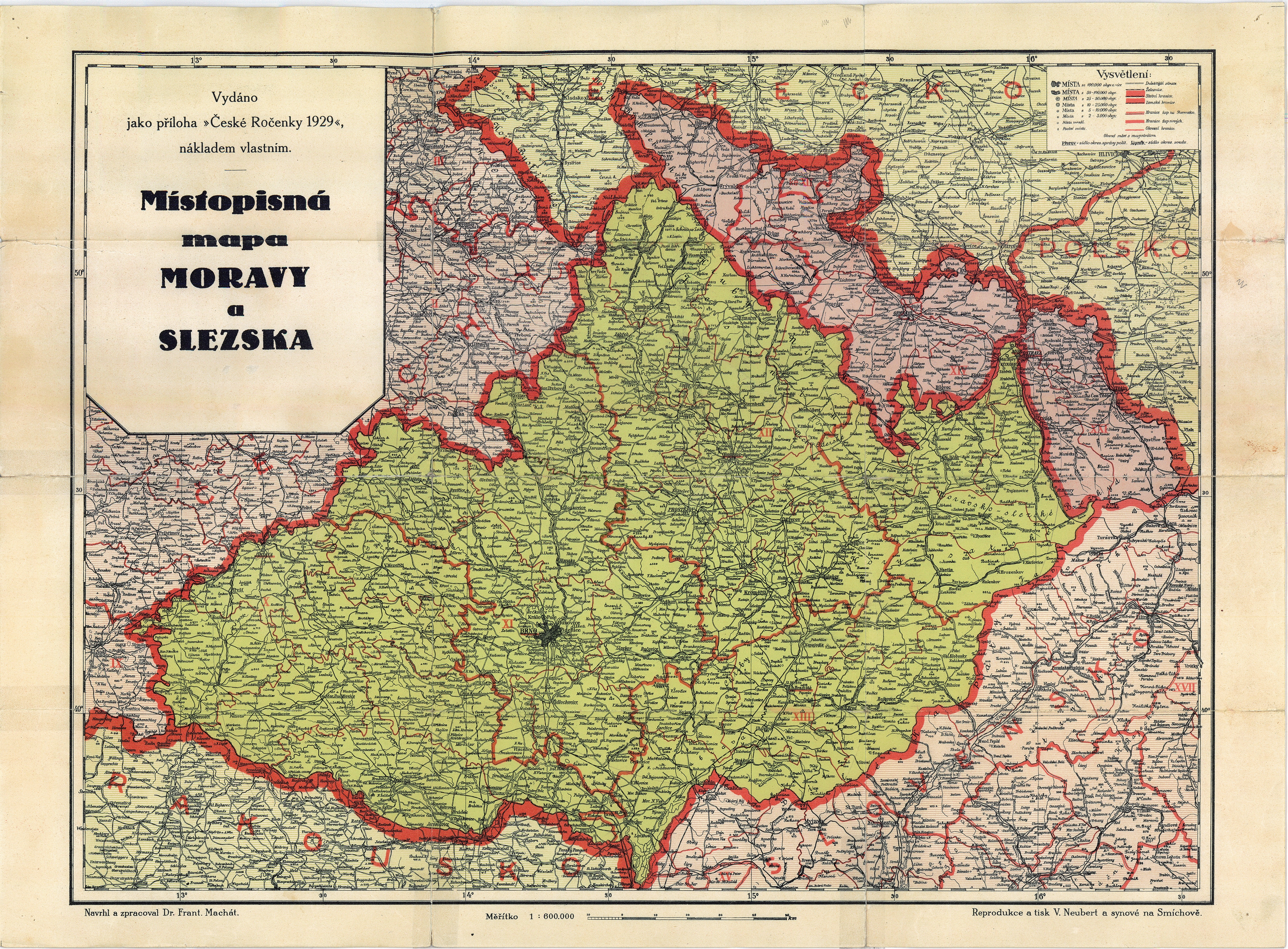
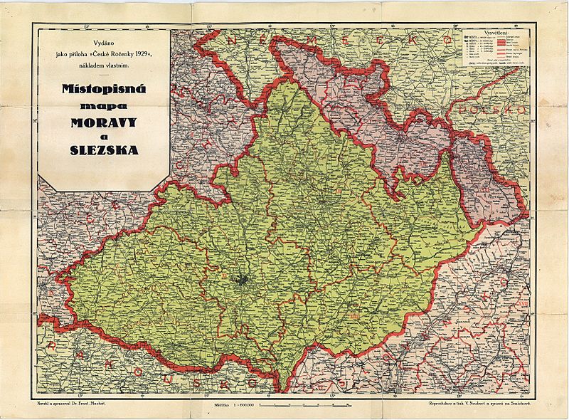
Image: Map of Moravia
Size of this preview: 800 × 590 pixels. Other resolutions: 320 × 236 pixels | 6,406 × 4,722 pixels.
Original image (6,406 × 4,722 pixels, file size: 18.47 MB, MIME type: image/jpeg)
Description: Political map of Moravia, published in Czechoslovakia 1929
Title: Map of Moravia
Credit: Školní zeměpisný atlas, Vlastnivědná ročenka, all published before 1930
Author: Dr. František Machát died 22.4. 1935 - more than 70 years
Usage Terms: Public domain
License: Public domain
Attribution Required?: No
Image usage
The following page links to this image:

All content from Kiddle encyclopedia articles (including the article images and facts) can be freely used under Attribution-ShareAlike license, unless stated otherwise.