
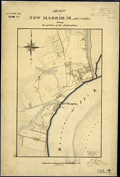
Image: Map of New Madrid, Mo., and Vicinity, showing the position of the fortifications. Surveyed & drawn by Louis... - NARA - 305776

Size of this preview: 408 × 600 pixels. Other resolutions: 163 × 240 pixels | 3,400 × 5,000 pixels.
Original image (3,400 × 5,000 pixels, file size: 5.2 MB, MIME type: image/jpeg)
Title: Map of New Madrid, Mo., and Vicinity, showing the position of the fortifications. Surveyed & drawn by Louis Boedicker, 1st Lieut., 2nd Mo. Arty., Assistant Eng.
Credit: U.S. National Archives and Records Administration
Author: Unknown authorUnknown author or not provided
Usage Terms: Public domain
License: Public domain
Attribution Required?: No
Image usage
The following page links to this image:

All content from Kiddle encyclopedia articles (including the article images and facts) can be freely used under Attribution-ShareAlike license, unless stated otherwise.