
Image: Map of Ontario NORTHERN

Size of this PNG preview of this SVG file: 340 × 330 pixels. Other resolution: 247 × 240 pixels.
Original image (SVG file, nominally 340 × 330 pixels, file size: 83 KB)
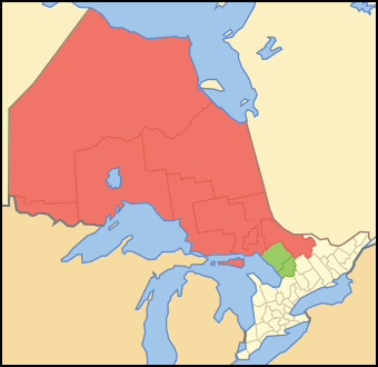
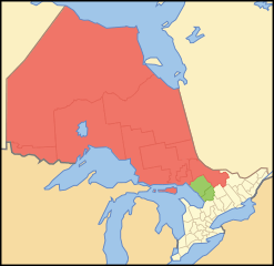
Description: Map showing en:Northern Ontario. Red is the districts always considered Northern Ontario. Green are the districts sometimes considered Northern Ontario.
Title: Map of Ontario NORTHERN
Credit: Crop and trace of Image:Canada (geolocalisation).svg; trace of Image:Ontario subdivisions.PNG.
Author: Vidioman
Usage Terms: Public domain
License: Public domain
Attribution Required?: No
Image usage
The following page links to this image:

All content from Kiddle encyclopedia articles (including the article images and facts) can be freely used under Attribution-ShareAlike license, unless stated otherwise.