
Image: Map of Oregon High Desert Country
No higher resolution available.
Map_of_Oregon_High_Desert_Country.jpg (428 × 317 pixels, file size: 21 KB, MIME type: image/jpeg)
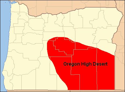
Description: Map of the of the High Desert of Oregon — in southeastern Oregon. Covering much of Crook, Deschutes, Harney, Lake, and Malheur Counties in Oregon. The moister northern High Desert region is part of the Columbia Plateau. The dryer southern High Desert region is part of the Great Basin region of Oregon.
Title: Map of Oregon High Desert Country
Credit: I created this work myself using as map format from Wiki-Commons
Author: Orygun
Usage Terms: Public domain
License: Public domain
Attribution Required?: No
Image usage
The following 2 pages link to this image:

All content from Kiddle encyclopedia articles (including the article images and facts) can be freely used under Attribution-ShareAlike license, unless stated otherwise.