
Image: Map of Peterloo Massacre
Size of this preview: 800 × 534 pixels. Other resolutions: 320 × 214 pixels | 2,403 × 1,605 pixels.
Original image (2,403 × 1,605 pixels, file size: 679 KB, MIME type: image/png)
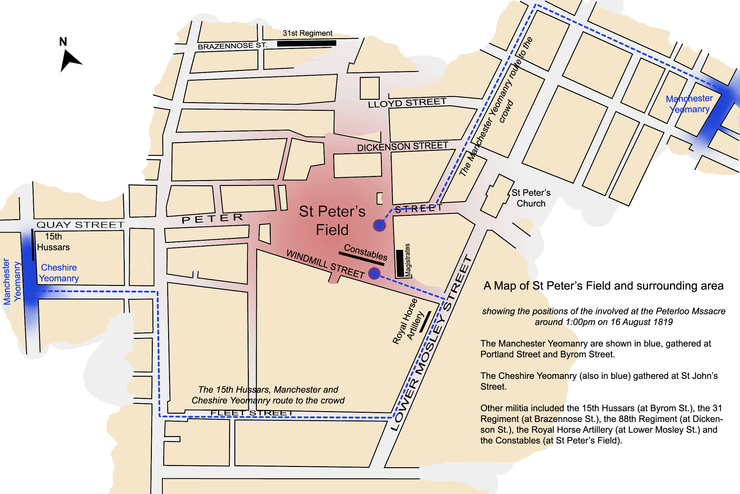
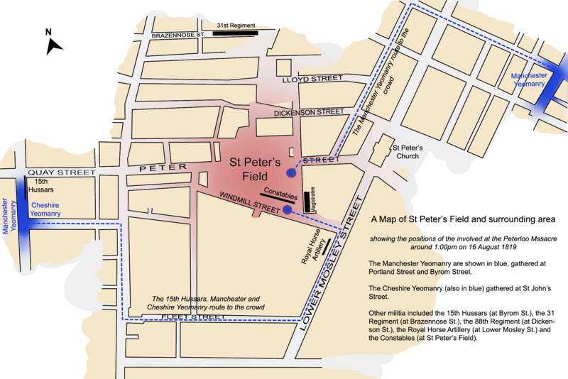
Description: A map of St Peter's Field, Manchester, England at the time of the Peterloo Massacre of 1819. This map, highlights the positions of those parties involved in the massacre as they were documented to have been at 1.00pm.
Title: Map of Peterloo Massacre
Credit: self-made but based on work in Reid, Robert (1989) The Peterloo Massacre, William Heinemann Ltd ISBN: 0434629014.
Author: Jhamez84
Usage Terms: Creative Commons Attribution 3.0
License: CC BY 3.0
License Link: http://creativecommons.org/licenses/by/3.0
Attribution Required?: Yes
Image usage
The following page links to this image:

All content from Kiddle encyclopedia articles (including the article images and facts) can be freely used under Attribution-ShareAlike license, unless stated otherwise.