
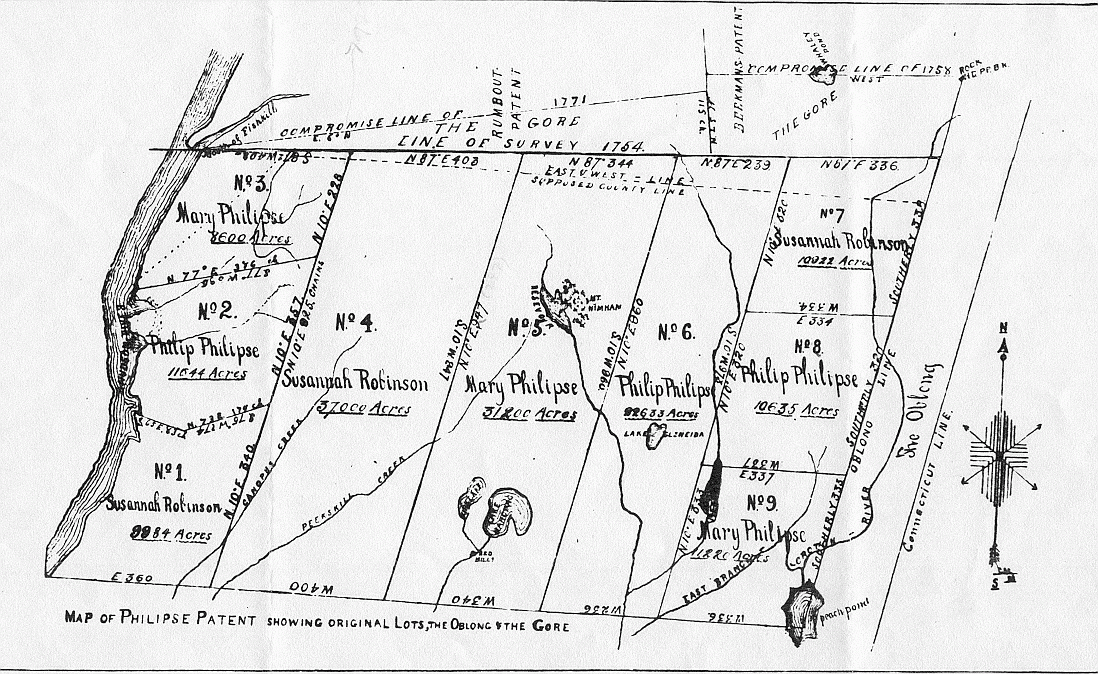
Image: Map of Philipse Patent (showing the Oblong and Gore)
Size of this preview: 800 × 491 pixels. Other resolutions: 320 × 196 pixels | 1,098 × 674 pixels.
Original image (1,098 × 674 pixels, file size: 651 KB, MIME type: image/png)
Description: Map of the Philipse Patent, a land tract in lower New York State that became Putnam County. Latest date on it is 1771.
Title: Map of Philipse Patent (showing the Oblong and Gore)
Credit: Old map (copyright expired) posted on government funded website by government funded employee
Author: None listed. County content administrator is listed as Ann Horn, a public employee
Usage Terms: Public domain
License: Public domain
Attribution Required?: No
Image usage
The following 5 pages link to this image:

All content from Kiddle encyclopedia articles (including the article images and facts) can be freely used under Attribution-ShareAlike license, unless stated otherwise.
.png)