
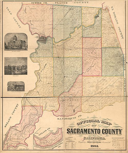
Image: Map of Sacramento County 1885

Size of this preview: 501 × 600 pixels. Other resolutions: 200 × 240 pixels | 1,963 × 2,350 pixels.
Original image (1,963 × 2,350 pixels, file size: 983 KB, MIME type: image/jpeg)
Description: Map of Sacramento County, California, 1885, showing civil townships
Title: Map of Sacramento County 1885
Credit: Library of Congress Geography and Map Division Washington, D.C. 20540-4650 USA dcu https://lccn.loc.gov/2012592093
Author: Shepherd, Fred. A. Britton & Rey.
Usage Terms: Public domain
License: Public domain
Attribution Required?: No
Image usage
The following page links to this image:

All content from Kiddle encyclopedia articles (including the article images and facts) can be freely used under Attribution-ShareAlike license, unless stated otherwise.