
Image: Map of Somerset County, New Jersey - Rocky Hill detail, 1850
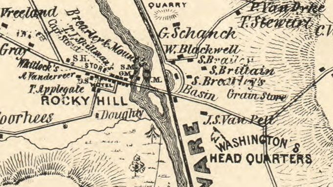
Description: General-content county map also showing rural buildings and occupants' names. Relief shown by hachures. Prime meridian: Washington D.C. "Entered according to act of Congress by Robert P. Smith A.D. 1850 in the ... eastern District of Pennsylvania." LC copy imperfect: Fold-lined, mounted on cloth backing. LC Land ownership maps, 464 Includes text, inset "Plan of Somerville", statistical table, key to abbreviations, illustrations of prominent buildings, and embellished map border. Available also through the Library of Congress Web site as a raster image. Detail This map detail shows the area around Rocky Hill, New Jersey, and in particular, the location of Washington's Headquarters at Rockingham in 1783. The house is shown as owned by J.S. Van Pelt in 1850.
Title: Map of Somerset County, New Jersey - Rocky Hill detail, 1850
Credit: https://www.loc.gov/item/2012593680/
Author: Otley, J. W.; Keily, James; Van Derveer, Lloyd; Smith, Robert Pearsall
Permission: This map is available from the United States Library of Congress's Geography & Map Division under the digital ID g3813s.la000464. This tag does not indicate the copyright status of the attached work. A normal copyright tag is still required. See Commons:Licensing for more information.
Usage Terms: Public domain
License: Public domain
Attribution Required?: No
Image usage
The following page links to this image:
