
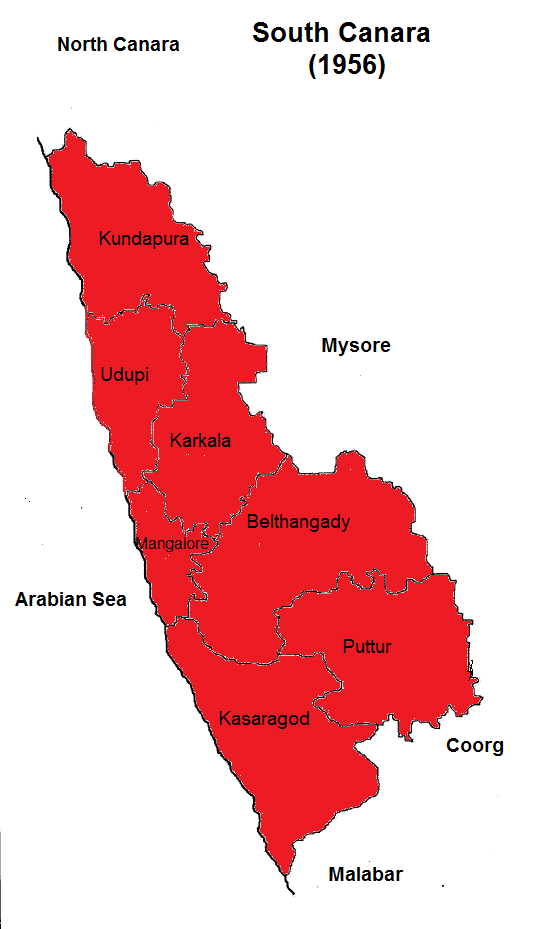
Image: Map of South Canara district in 1956. Self work.
Size of this preview: 351 × 598 pixels. Other resolutions: 141 × 240 pixels | 545 × 929 pixels.
Original image (545 × 929 pixels, file size: 54 KB, MIME type: image/png)
Description: South Canara was a district of Madras State in India. The district has been divided into three districts. Udupi and Dakshina Kannada in Karnataka and Kasaragod in Kerala.
Title: Map of South Canara district in 1956. Self work.
Credit: Own work
Author: Linguisticgeek
Usage Terms: Creative Commons Attribution-Share Alike 4.0
License: CC BY-SA 4.0
License Link: https://creativecommons.org/licenses/by-sa/4.0
Attribution Required?: Yes
Image usage
The following page links to this image:

All content from Kiddle encyclopedia articles (including the article images and facts) can be freely used under Attribution-ShareAlike license, unless stated otherwise.