
Image: Map of Sri Jayawardenapura Kotte (1557 -1565)
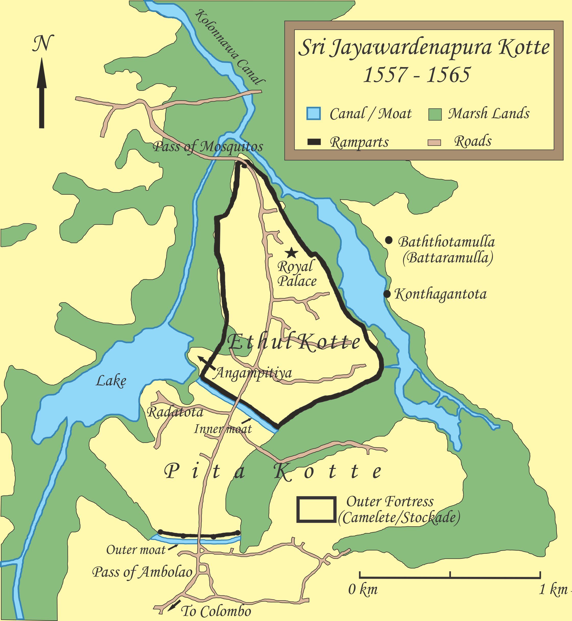
Description: Map of Sri Jayawardenapura Kotte and its defenses from 1557 - 1565. Map based on following sources; - Map of Sri Jayawardenapura Kotte by historian Douglas D. Ranasinghe. -Details in “Fernao de Queyroz. The temporal and spiritual conquest of Ceylon. AES reprint. New Delhi: Asian Educational Services; 1995. ISBN 81-206-0765-1” -Map of Jayawardenapura Kotte and environ “Paul E.Peiris. Ceylon the Portuguese Era: being a history of the island for the period, 1505-1658 - Volume 1. Tisara Publishers Ltd:Sri Lanka; 1992. p 142-143”
Title: Map of Sri Jayawardenapura Kotte (1557 -1565)
Credit: Created using a drawing software
Author: Nishadhi
Usage Terms: Creative Commons Attribution-Share Alike 3.0
License: CC BY-SA 3.0
License Link: https://creativecommons.org/licenses/by-sa/3.0
Attribution Required?: Yes
Image usage
The following 3 pages link to this image:

.png)