
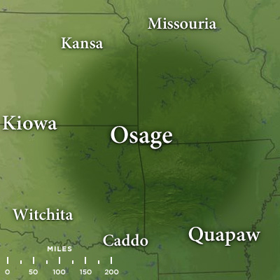
Image: Map of Traditional Osage Tribal Lands by Late 17th Century
No higher resolution available.
Map_of_Traditional_Osage_Tribal_Lands_by_Late_17th_Century.jpg (400 × 400 pixels, file size: 43 KB, MIME type: image/jpeg)
Description: A regional map showing the extent of traditional Osage Nation lands by the late 17th century superimposed upon the current states of Arkansas, Kansas, Missouri, and Oklahoma.
Title: Map of Traditional Osage Tribal Lands by Late 17th Century
Credit: Photoshop composition
Author: MonsMonstrum
Usage Terms: Creative Commons Attribution-Share Alike 3.0
License: CC BY-SA 3.0
License Link: http://creativecommons.org/licenses/by-sa/3.0
Attribution Required?: Yes
Image usage
The following 2 pages link to this image:

All content from Kiddle encyclopedia articles (including the article images and facts) can be freely used under Attribution-ShareAlike license, unless stated otherwise.